Using Arboreal Tree Height Data in GIS Applications
Johan Ekenstedt
01 Feb 2022
The Arboreal Tree Height app not only helps you measure trees but also saves the GPS coordinates of each measured tree. This feature opens up exciting possibilities for mapping and analyzing your tree data using Geographic Information System (GIS) software. In this tutorial, we'll walk you through the process of exporting your tree data and using it in QGIS, a free and open-source GIS application.
Exporting Data from Arboreal Tree Height
- Open the Arboreal Tree Height app on your device.
- Navigate to the results page for the tree measurements you want to export.
- Press the share button.
- Choose to send the CSV file to yourself via email.
- Save the received files on your computer.
Importing Data into QGIS
- Download and install QGIS from the official website if you haven't already.
- Open QGIS on your computer.
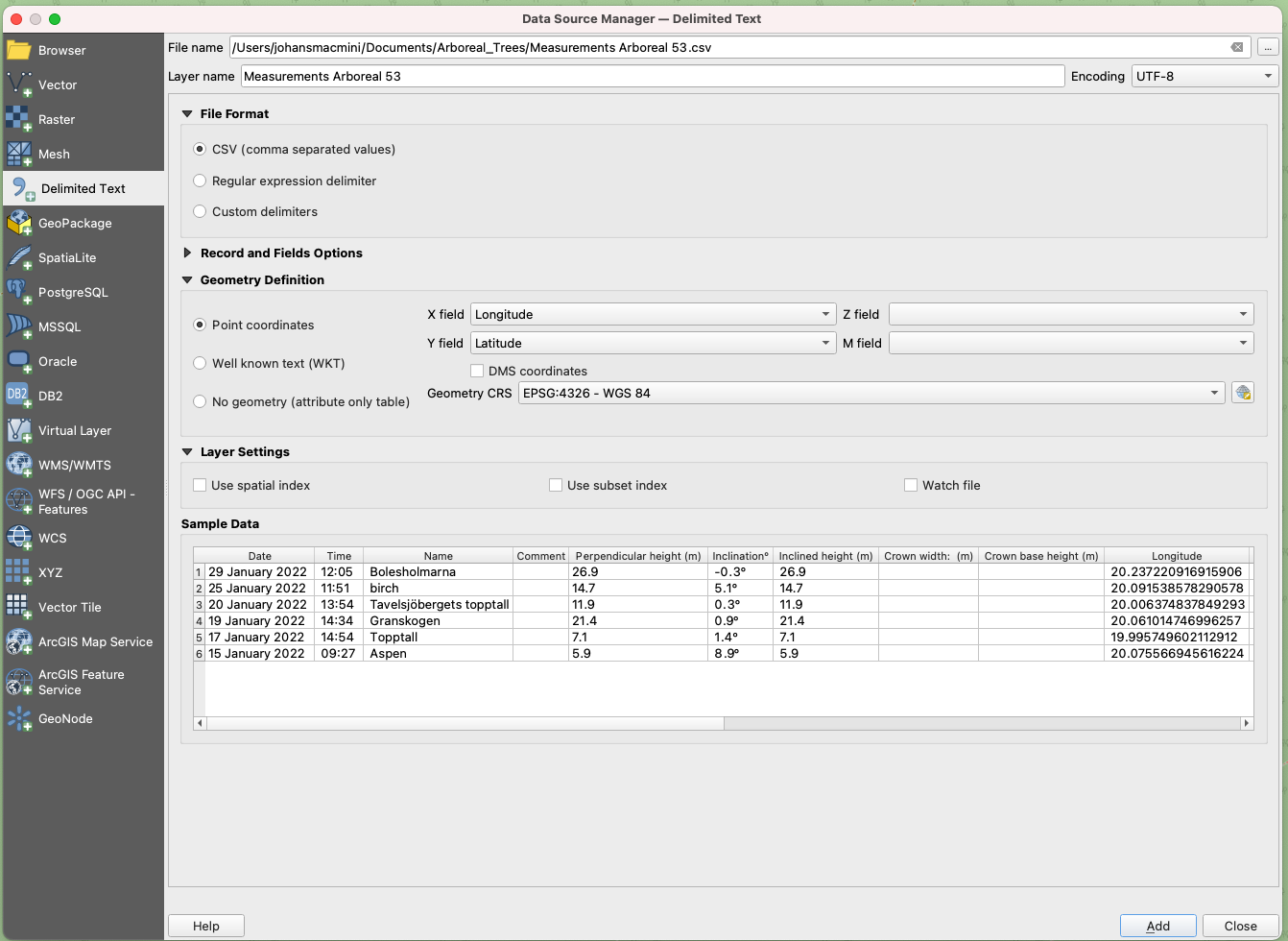
- Look for the "Manage Data Sources" dialog on the upper left side of the screen.
- Choose the CSV file you exported from Arboreal Tree Height (it will end with .csv).
- Set the following import parameters:
- Projection: EPSG:4326 - WGS 84
- Encoding: UTF-8
- Click "Add" and then close the dialog.

Working with Your Tree Data in QGIS
Once your data is imported, you can start exploring and analyzing it:
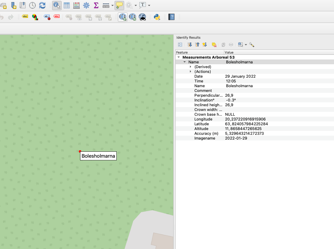
- Use the "Identify Feature" tool to click on any tree point and view its information.
- Right-click on the layer in the Layers panel to access more options, such as exporting to a shapefile format.
Tips for Advanced Users
- While this tutorial focuses on QGIS, the process works even better in ArcMap and ArcGIS Pro if you have access to those applications.
- Experiment with different base maps and overlay your tree data for more context.
- Use QGIS's analysis tools to calculate distances between trees, create density maps, or perform other spatial analyses.
By combining the power of Arboreal Tree Height's accurate measurements with GIS software, you can gain valuable insights into your forest inventory, plan management strategies, or conduct scientific research more effectively.
We encourage you to try this workflow and explore the possibilities of visualizing and analyzing your tree data in a spatial context. If you have any questions or want to share your GIS projects using Arboreal Tree Height data, feel free to reach out to our community forum!