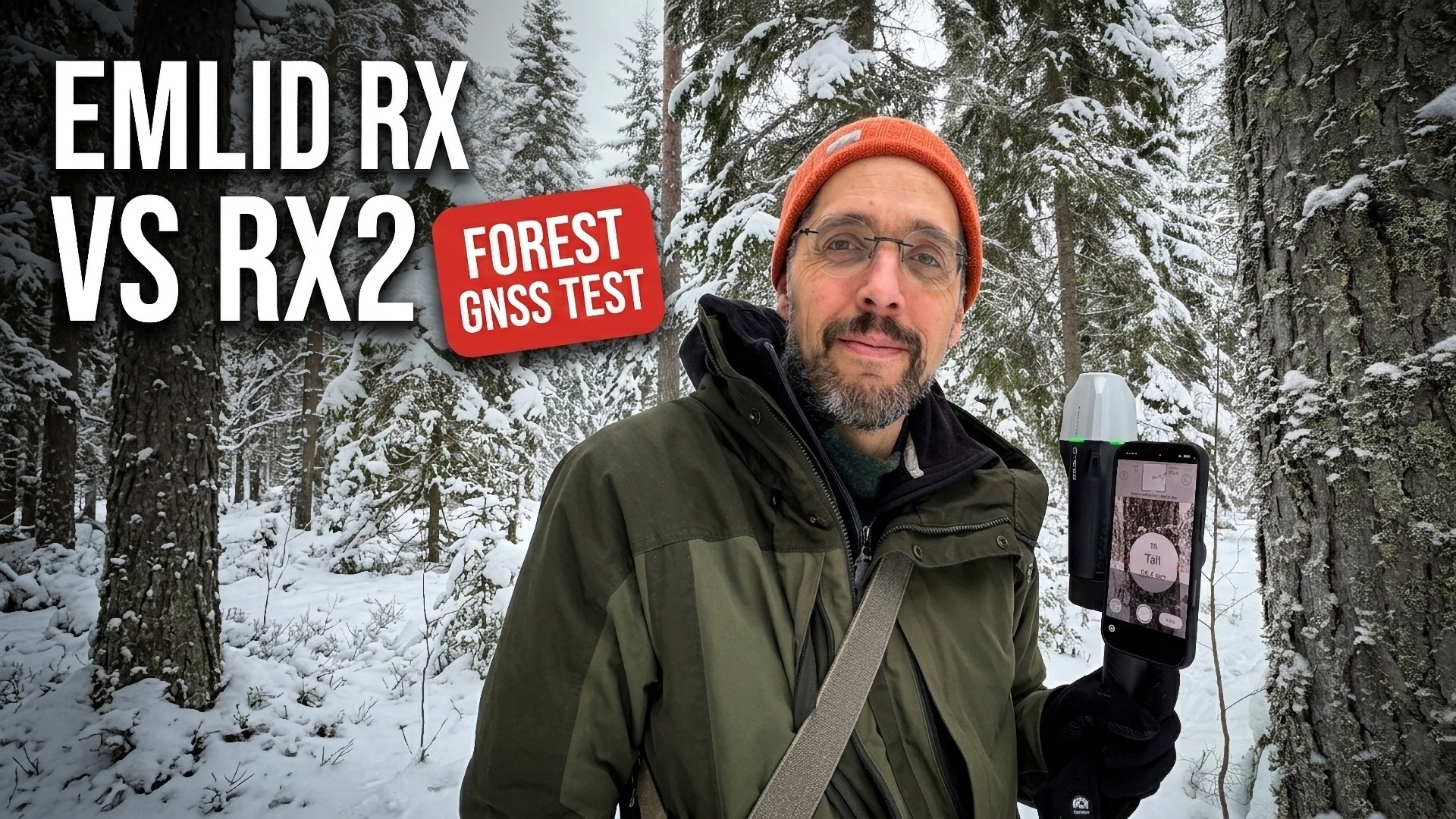
Emlid RX2 Review — Is It Worth the Upgrade?
Johan Ekenstedt
8 Mar 2026
How accurate is GNSS positioning under a forest canopy — and does it really matter which device you use? We set out to answer that question by comparing three different positioning sources: the Emlid Reach RX, the newer Emlid Reach RX2, and the internal GPS built into a smartphone.
What is RTK GNSS?
RTK (Real-Time Kinematic) is a technique that improves GNSS positioning from meter-level down to centimeter-level accuracy. It works by receiving a correction signal from a nearby base station or a network of base stations (often called NTRIP). The GNSS receiver compares its own satellite observations with the corrections and can resolve its position with much higher precision.
This means the receiver needs an internet connection to receive the corrections — via cellular network, Wi-Fi, or satellite internet. In areas without cell coverage, satellite communicators or pre-planned alternatives may be needed. Both the Emlid Reach RX and RX2 receive the correction signal through the phone they are connected to, so as long as your phone has internet access, you are good to go.
The test setup
Using the Arboreal Tree app, we measured the same four trees on five different days at different times of day. The app calculates the tree position by combining the GNSS position with the compass bearing, the distance to the tree, and the radius of the tree trunk. This means the resulting position represents the estimated center of the tree.
Since we do not know the exact true position of each tree, we instead evaluated repeatability — how consistently the devices place the same tree across multiple visits. By measuring on different days and at different times, we reduce the risk of systematic bias and can be confident that the results reflect real-world performance.
Fix matters — check the green light
One critical finding: accuracy depends heavily on getting a fixed RTK solution from the correction signal. Always make sure the indicator light on the device is green before measuring. A float or single solution will give significantly worse results.
This is where the RX2 really shines. During our walks through the forest, the RX lost its fix 8 times more often than the RX2.
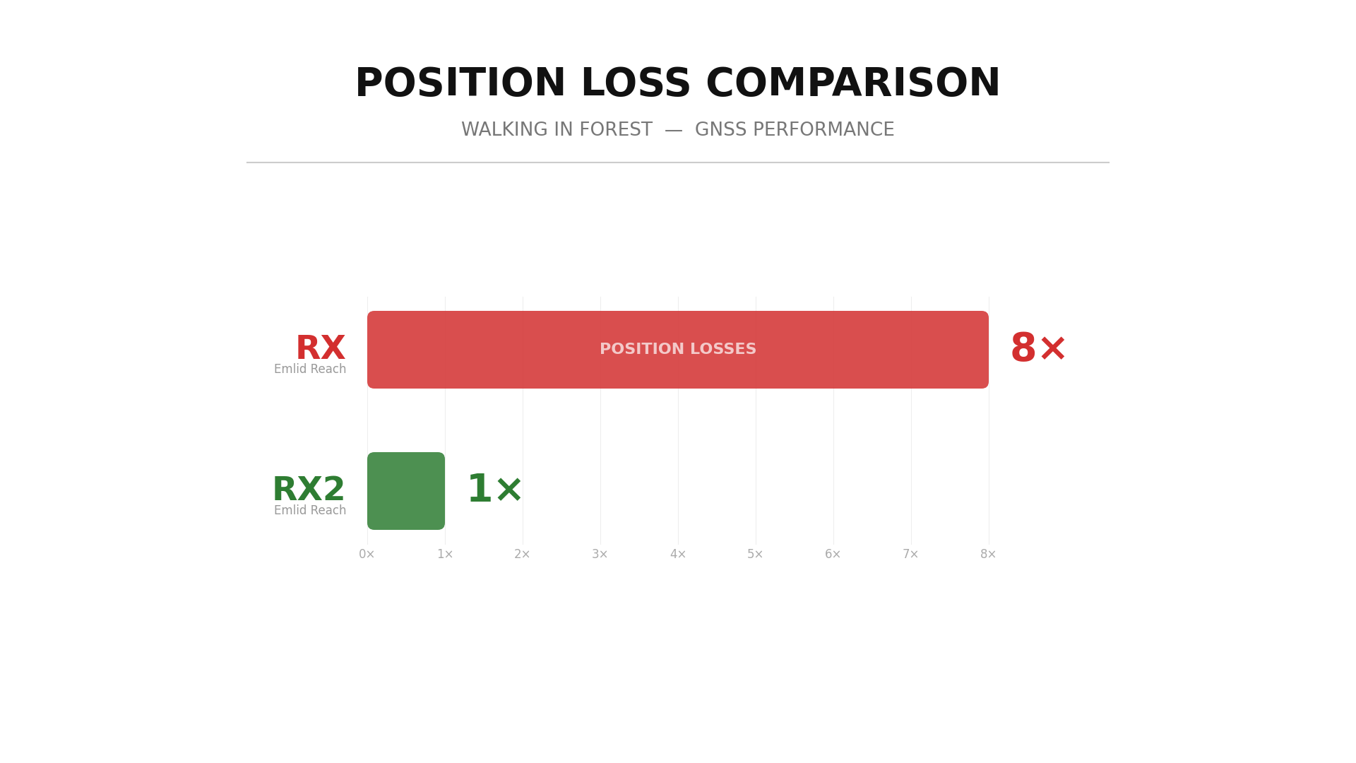
The Reach RX2 maintains a stable fix much more reliably under canopy, which translates directly into more usable measurements in the field. And when the RX2 does lose its fix, it regains it faster — meaning the time spent with poor accuracy is shorter.
With a fix, all positions land inside the tree
When both the RX and RX2 had a fixed solution, the results were impressive. Every single measured position fell within the actual tree trunk, as shown by the circles representing the field-measured trunk diameter.
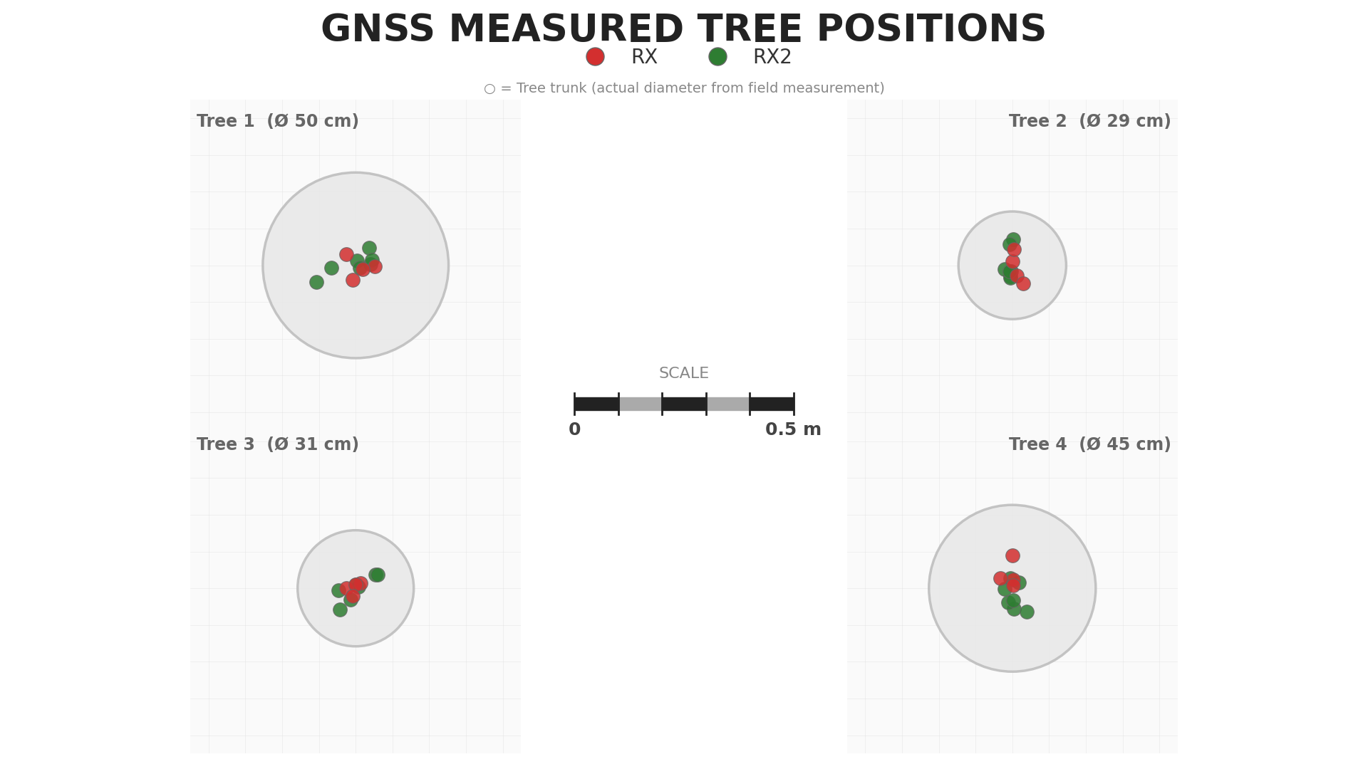
Both devices deliver centimeter-level repeatability when operating with a fix — the RX at 3.3 cm RMSE and the RX2 at 4.8 cm. The slight difference in numbers should not be interpreted as the RX being more accurate than the RX2. The measurements were not taken on the same days, and with only five visits per device the sample size is too small to draw conclusions about differences at this level. In practice, we consider them equally accurate when they have a fix.
Internal phone GPS — a different story
When we add the internal phone GPS to the comparison, the difference is striking. The phone positions scatter several meters from the tree center, often landing well outside the trunk.
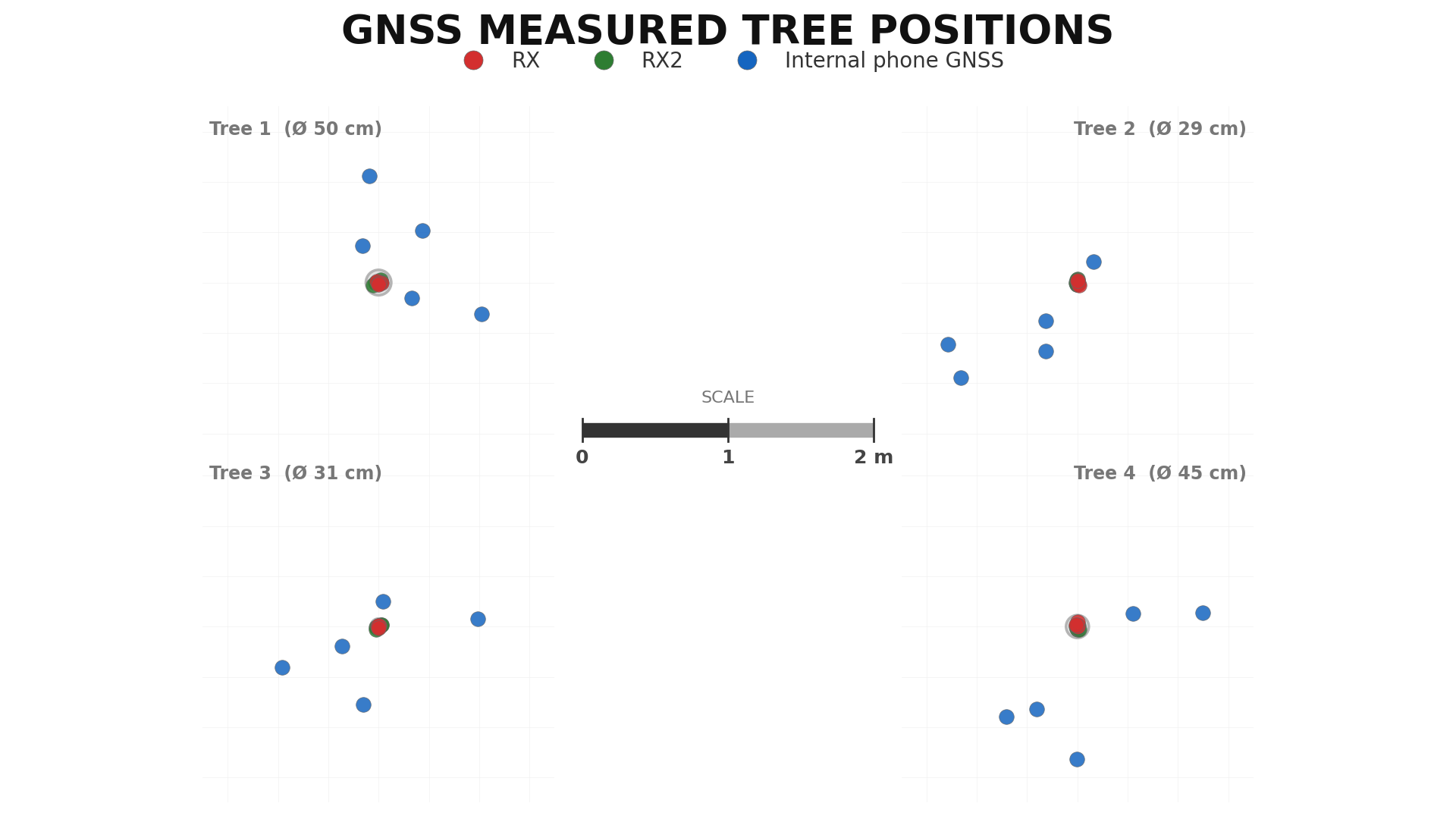
Note the scale difference — the tree circles are barely visible at this zoom level because the phone positions are so far off.
The numbers
The full accuracy comparison confirms what the figures show visually:
| Device | RMSE | CEP50 | CEP95 | Max Error |
|---|---|---|---|---|
| Emlid Reach RX | 3.3 cm | 2.5 cm | 5.1 cm | 5.3 cm |
| Emlid Reach RX2 | 4.8 cm | 3.8 cm | 7.1 cm | 11.2 cm |
| Internal phone GNSS | 183.5 cm | 170.2 cm | 285.3 cm | 299.5 cm |
- RMSE — Root Mean Square Error, average distance from the centroid of each tree
- CEP50 — Circular Error Probable, radius containing 50% of measurements
- CEP95 — 95th percentile, radius containing 95% of measurements
The Emlid Reach devices achieve centimeter-level repeatability — up to 40 times more precise than the internal phone GPS, which had an RMSE of 183.5 cm and a maximum error of nearly 3 meters.
Why accurate positioning matters
Getting the correct global position of a tree is essential when you need to:
- Compare with other datasets — aerial imagery, drone data, or terrestrial laser scanning all rely on accurate coordinates to match trees between sources
- Revisit specific trees — in urban forestry, monitoring programs, or long-term studies, you need to be sure you are collecting data from the right tree
- Fuse field and remote sensing data — combining ground truth with LiDAR point clouds or satellite imagery requires positions that actually align
Supported in both Arboreal apps
We support the Emlid Reach RX and RX2 in both of our applications — Arboreal Tree and Arboreal Forest. If accurate tree positioning is important for your work, an external GNSS receiver is a worthwhile investment. And based on our testing, the RX2's improved ability to maintain a fix under canopy makes it the stronger choice for forest environments.
Video version
Prefer watching over reading? Check out the video version of this review on YouTube.
Written by

Johan Ekenstedt
CEO and iOS developer at Arboreal. Making it easier to measure, understand and manage trees and forests.
LinkedIn